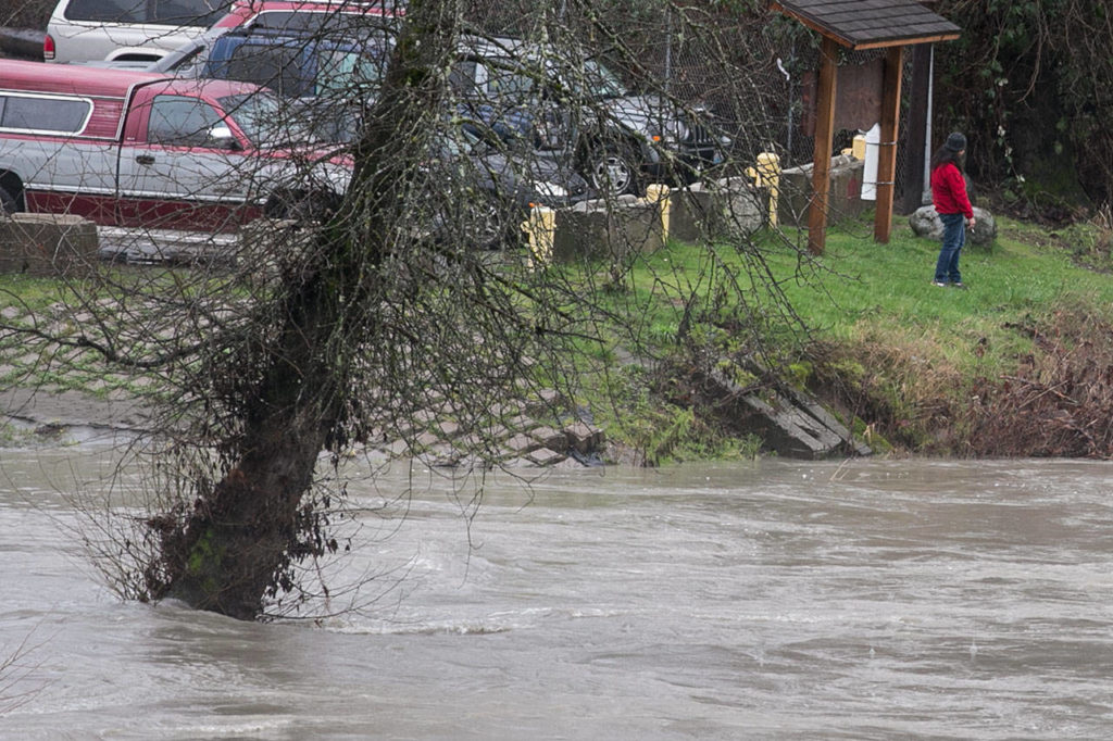
SNOHOMISH — Rivers around Snohomish County were receding Monday, though still running high and fast after an earlier surge.
Snow levels in the mountains have continued to drop, and rain showers could last into midweek, according to the National Weather Service. Parts of the county saw nearly 1.75 inches of rain between Saturday and Sunday.
The soggy weekend saturated slopes and hillsides, causing several landslides and a warning that the danger could persist regionally. On Monday, Highway 9 near the Skagit County line and Old Highway 99 east of Silvana were closed because of mud and debris.
In Silvana, earth “slipped down the hill and covered the road,” fire Capt. Gino Bellizzi said. “It’s just a little bit of a hassle, but it doesn’t cause any huge problems for anybody.”
- Related

This homeowner embraces the cycle of life in a flood zoneFeb 5, 2018
Flooding was not as bad as in November, when the Pioneer Highway was closed at both ends, he said. The highway was closed again at the east end Monday. Some Arlington School District buses also were on alternate routes.
“We just went around town and made sure everyone was okay,” Bellizzi said. “It looked like the river was forecast to do a lot more, but it didn’t.”
No homes were threatened by the Silvana-area slide, estimated to be 100 feet long. At least two small spots on the slope on the north side had fresh mud from apparent sliding. Work was scheduled to remove the debris.
On Highway 9, commuters between Snohomish and Skagit counties should make alternate plans, according to the state Department of Transportation.
ICYMI: Two different highways in our area won’t be available for your Monday morning commutes.
🚧 SR 11 closed about 7 miles south of BHam’s Fairhaven neighborhood (mp 10-13).
🚧 SR 9 closed south of Mount Vernon (Lake McMurray) near Skagit/Snohomish county lines. pic.twitter.com/VonufibQmp— WSDOT North Traffic (@wsdot_north) February 5, 2018
Sounder trains in south county also were suspended Monday for similar issues, with service expected to resume Tuesday.
Snohomish County offers maps online of slopes known to pose a risk, said Jason Biermann, the director of emergency management.
“If you’re in or around any of those areas that are prone to sliding, pay attention,” he said.
Officials brought a crane to the U.S. 2 trestle to handle logs and other debris carried by the swollen Snohomish River. If not removed, the flood flotsam increases pressure on the trestle’s support columns and adds to upstream flooding.
Eastbound commuters should plan for delays Monday afternoon because the crane is squatting in the peak-use shoulder lane. It is expected to remain there at least until Tuesday morning, state officials said.
Other weather-related road closures were reported around Snohomish, including 10th Street and Railroad Avenue, as well as near Granite Falls and Lake Stevens, such as Hartford Road. Biermann reminds people to report property damage to the county.
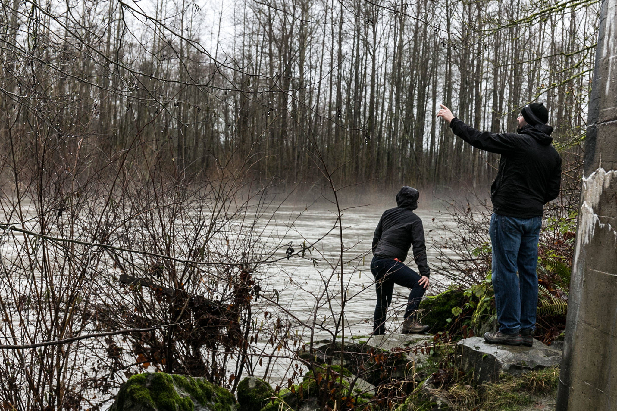
“We’re still watching the Pilchuck River closely,” he said. “I know there’s some concerns from homeowners out there.”
During potential flooding, firefighters from Snohomish, Monroe and Clearview all coordinate on routes in case of road closures, Snohomish Fire Chief Ron Simmons said. The area usually gets hit worse about an hour after the rivers crest, he said. The Pilchuck peaked on Sunday evening, and the Snohomish followed the next morning without surpassing minor flooding stage.
Looking at the Stilly from the Centennial Trail near Haller Park in #Arlington. Water is high and very fast. pic.twitter.com/PWukEcdCLN
— Kari Bray (@KariBray) February 5, 2018
Rikki King: 425-339-3449; rking@heraldnet.com; Twitter: @rikkiking.
Talk to us
> Give us your news tips.
> Send us a letter to the editor.
> More Herald contact information.
Gallery