By Julia Duin
Special To The Washington Post
Everyone loves a grand circle, and this was mine: A 2,200-mile loop through British Columbia that showcased water, mountains, remnants of volcanoes and the storied sites of Canada’s gold-rush and fur-trade eras.
It meant driving the length of Vancouver Island, taking a 16-hour ferry north on the Inside Passage, heading east on the Yellowhead Highway, then south down the Cariboo Gold Rush trail.
The highways on the loop are paved two-lane roads with plenty of services, tons of things to do and more beauty than we deserved.
Planning a 12-day jaunt around British Columbia with an 11-year-old in tow was not hard. Two ferry connections had to be booked months in advance, but all our other reservations were made two weeks or less before we set out on a Sunday in mid-August.
Although we drove up from Seattle, it’s easier to fly into Vancouver, grab a car and head for the ferry dock at Tsawwassen, just south of the airport. The views of the Coast Mountains during our two-hour ride across the Strait of Georgia were stunning. We disembarked in Nanaimo, a mid-sized city best known as the site of the annual World Championship Bathtub Race.
We headed for Coombs, a small town on Highway 4A west of Nanaimo. You can’t miss the Old Country Market, a wildly eclectic grocery store with billy goats perched on its roof, contentedly munching grass. Across the street was the Billy Gruff Creamery, where we sampled a few of the 69 flavors of ice cream and Italian gelato.
The next day, we headed west on Highway 4 to Cathedral Grove, a meandering walk through an 800-year-old strand of Douglas firs and cedar. Nine miles to the west was Port Alberni, at the head of a long inlet that leads to the Pacific.
Helpful huts
Canada has these amazing travel-friendly visitor centers that are marked with giant question-mark signs, stocked with maps and guides that one cannot find online. Folks at the Port Alberni center directed us to Serious Coffee, a local java spot, then to Harbour Quay, home to several seafood eateries and picnic tables with sweeping views of the mountains.
On the way back, we drove past farms selling garlic, sheep and lambs, ending up at the community beach in the town of Parksville, where the salty sea was clear, shallow and quite warm. The boardwalk, the food carts, the play area and tiny water park, together with the periwinkle blue mountains shimmering across the strait on a late afternoon, felt perfect.
The next morning, we meandered past wineries, galleries, candle makers and glass-bead shops, ending up in Campbell River, a town known for snorkel-with-salmon tours for the millions of the fish that arrive there in the late summers.
Twenty-five miles to the west on Highway 28 was Strathcona Provincial Park, the unsung jewel of the island’s park system. The mountains dive straight down into Buttle Lake underneath the snow-capped Elk River Mountains. We drove down to the waterfront by the Strathcona Park Lodge and Outdoor Education Center, where we found a boat house that offered rentals of motorboats, kayaks and canoes, as well as a secluded kids beach with floaties and barriers.
Although not as well publicized as its southern half, the northern part of Vancouver Island includes many amazing getaways, wilderness destinations and coastal lodges. An antique sawmilling village on Johnstone Strait, known as Telegraph Cove, is packed with sightseers who come for the whale-watching expeditions or fishing trips. There is also a cafe, restaurant, shops and lodgings dating back to the 1920s and 1930s.
We opted to stay in less expensive digs at the Inlet Haven Bed and Breakfast in Port Alice, a town on one of the coves off the island’s West Coast. Set on a hill facing due west, it is the site of a closed pulp mill that provided 75 percent of the town’s tax base and half of its jobs. But it shut down in February 2015, leaving about 500 residents, including B&B owners Bonnie and Jim Overland. The couple make the trip worthwhile, as they take visitors on drives to hidden places in the hills, such as pristine Alice Lake.
The next day, we were up at 4:30 a.m. to catch a 16-hour ferry ride from Port Hardy, a town on Vancouver Island’s northern tip, to Prince Rupert. Named after a 17th-century British royal, this remote city is 117 miles south of Ketchikan, Alaska. The boarding process was lengthy and disorganized, but once on board, it was pleasant. Many of us took refuge on the glassed-in sixth-floor sun deck to gaze upon hundreds of miles of forested mountains, occasional lighthouses, canneries, waterfalls and scattered settlements along the Inside Passage. We disembarked close to midnight, then sped off to the Black Rooster Guesthouse, an upper-crust hostel a mile from the dock.
The next day, we headed to the visitor center by the waterfront, where there was an enlightening exhibit on Prince Rupert, which boasts North America’s deepest natural harbor. It’s also one of the continent’s fastest-growing and most secure ports. Canada is investing millions into increasing the port’s capacity by 60 percent, which means an increase in jobs, rail traffic and more access to the region’s vast timber, coal and oil resources.
There’s much to do in the area, including ferry trips to the Haida Gwaii islands and boat rides to a grizzly sanctuary. Instead, we drove 12 miles to the North Pacific Cannery, the oldest intact one on the West Coast. Located just outside tiny Port Edward, it consists of buildings on stilts in the shallow waters of the Inverness Passage. All the old canning equipment and nets from its 83-year history are still there, and the guided tour is fascinating.
On the Yellowhead Highway
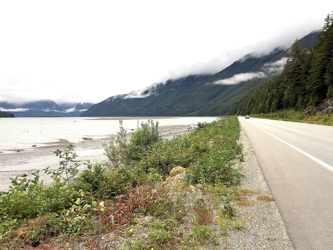
The next morning, we hit the Yellowhead Highway, a 1,840-mile route from British Columbia to Manitoba. We found delight in the 90-mile drive from Prince Rupert along the Skeena River, which is known for its beauty and sheer peaks-to-water views.
Once in Terrace, we stopped at Xanders, a funky coffeehouse on Lakelse Street, then followed the Tseax River north on Nisga’a Highway 113 to Nisga’a Memorial Lava Bed Provincial Park. During the 18th century, a volcano erupted here, killing roughly 2,000 people and burying 39 square miles in lava.
On certain days during the summer, there are guided hikes to a viewpoint overlooking the crater. The park also offers self-guided tour stops along the highway. As we drove, the mountains got steeper and lovelier. Eventually, we encountered the lava beds. These acres of jagged blue-black rocks mark a path of destruction along the Tseax River Valley.
Several miles to the west was Gitlaxt’aamiks, where to our delight, a pedestrian bridge arched over the churning river far below. Several more villages and the new Nisga’a Museum of aboriginal art lay farther to the west along the paved highway, said to be one of the province’s most breathtaking drives. But rain clouds chased us back to Terrace, then east along Highway 16, where we arrived in the town of Smithers two hours later. We managed to slide into a booth at Trackside Cantina just before it closed at 9 p.m.
Smithers was founded a century ago as a stop on the Grand Trunk Pacific Railway that ended in Prince Rupert. It has a downtown with an Alpine motif and a ski area. We headed east on Highway 16. An hour before Prince George, we arrived at Fort St. James, a historic fur-trading center founded in 1806 by Simon Fraser, the dashing entrepreneur and explorer who opened up western Canada for the British. All the displays at this restored fort are set in the year 1896. During the evenings, it doubles as a bed-and-breakfast. We stayed in the Officer’s Dwelling House, which was romantically dark with a few strategically placed lamps.
I later learned this is the only national park in Canada where people can sleep in historic dwellings.
“We thought, ‘Why not?’” site manager Bob Grill told me later. “It’s really worked, and B&Bs are popular these days. Yes, you have to go to another building for the bathroom, but that’s all part of the experience.”
The following morning, a cold wind was blowing from Lake Stuart, on which the fort sits. Day visitors played with a huge outdoor “historic game box” that had croquet, horseshoes, ropes for tug-of-war and a collection of sticks and beribboned hoops for the game of graces, a popular Victorian activity for girls. Even more popular were the daily chicken races, involving five chickens from a nearby coop running down a short track, to the delight of the tourists who bet on which chicken might win. (Ours lost.)
Alive with history
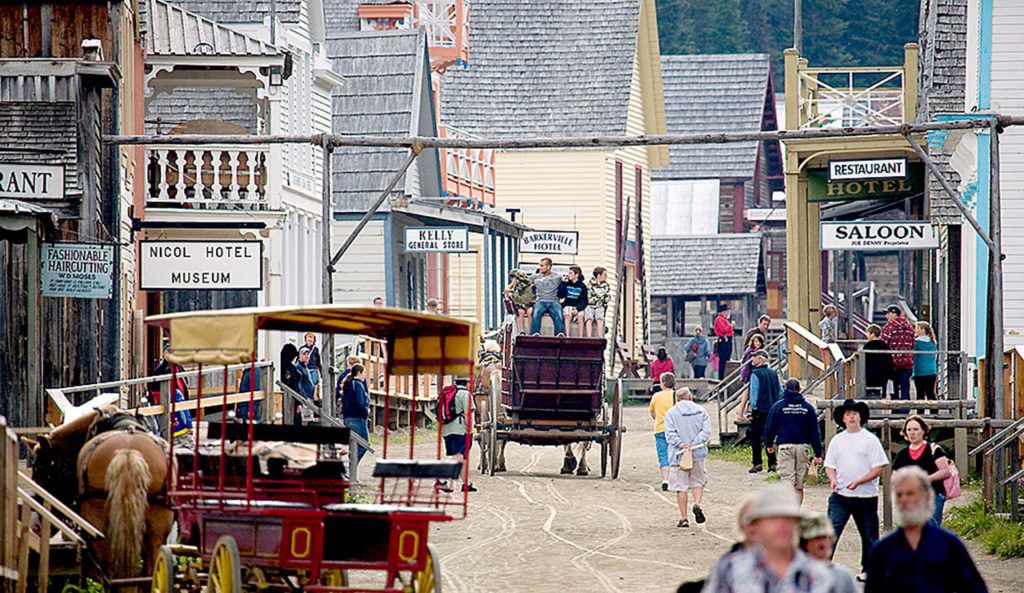
Our next historic Canadian site encounter was Barkerville, about a three-hour drive from Fort St. James. Passing Prince George, we headed south on Route 97, then east on Highway 26 into the hills to what could be considered the largest living-history museum in western North America. Barkerville is named after a British prospector named Bill Barker, whose gold strike at the depth of 52 feet near Williams Creek in 1862 revealed the world’s largest creekside gold-nugget deposit. Once word of Barker’s find got out, the world rushed to join him.
Today, the town has 169 historic buildings or their replicas on 1,130 acres, a corps of costumed actors, historic cemeteries, bed-and-breakfasts and surrounding campgrounds to accommodate 50,000 to 60,000 visitors annually. People dressed in mid-19th century garb filled us in on the daily life in Barkerville. About a third of the village was known as Chinatown, after the thousands of southeastern Chinese who sought their fortune in North America. There were enough activities to fill several days, and we wisely chose to stay in one of the B&Bs, as there aren’t many other local lodgings.
After two nights there, we followed the Cariboo Gold Rush Trail down Highway 97. The first prospectors got to Barkerville via the Cariboo Wagon Road, which was begun at the small mountain town of Lillooet in 1859. As it was being built, rest stops and inns known as road houses sprang up, naming themselves after the road’s mileposts.
We drove back down the route, stopping at 150 Mile House, where we found a restored 1896 schoolhouse. Children can practice dipping quill pens into inkwells, which fascinated my daughter.
Instead of taking a faster route back to Vancouver, we turned off Highway 97 to head down the more scenic Highway 99 to Lillooet. Fill up on gas at the Hat Creek Ranch junction, as there’s nowhere else to buy it for miles. The drive with hairpin turns and steep drops down the Upper Fraser Canyon had stark, dramatic views of the surrounding mountains and sheer cliffs in the late afternoon sun. Finally, we reached Lillooet, which was on a hill overlooking the Fraser River.
The sun dropped behind the mountains after sending forth one last, golden shard. We had miles to go before we slept, but for us, the gold miners’ beginning was our end. From the covered wagons to the ferries and from the 19th century to the 21st, our circle was complete.
Talk to us
> Give us your news tips.
> Send us a letter to the editor.
> More Herald contact information.


