You don’t have to go into the backcountry to hike through Snohomish County’s wilderness.
While many great hikes can be found off Mountain Loop, Cascade Loop or Stevens Pass highways, the county also has an array of urban trails that can be found in your back yard. They may be surrounded by civilization, but once you step into the forest, it feels as though you’re miles away.
Here are some suggestions for hikes in the county that include trails to beaches, through mature forests and around lakes. Most of these trails are easy to get to and many can be hiked year-round. None of these hikes requires a special park pass.
Paradise Valley
23210 Paradise Lake Road, Woodinville
The former farm and logging homestead near Maltby has forest, wetlands, streams and more than 13 miles of hiking, biking and equestrian trails. Print a trail map from snohomishcountywa.gov before you set out. Each of the trail legs and loops are well marked, making it easy to customize your hike. Stop after a half-mile loop or continue on until you’ve hiked all 13 miles. Follow the perimeter trails of the 790-acre Paradise Valley Conservation Area for a 5-mile hike. A clearing along the Mainline Trail has a picnic table. A portable restroom is in the parking lot. Most trails are level but some have a gain of up to 300 feet.
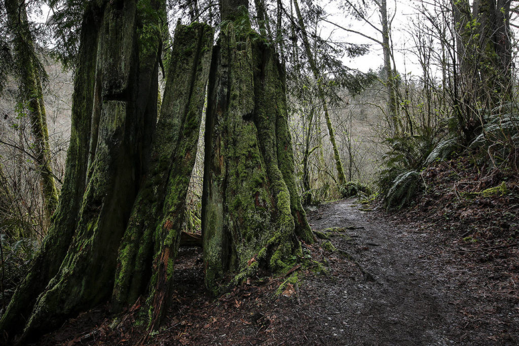
Lund’s Gulch
6026 156th St. SW, Edmonds
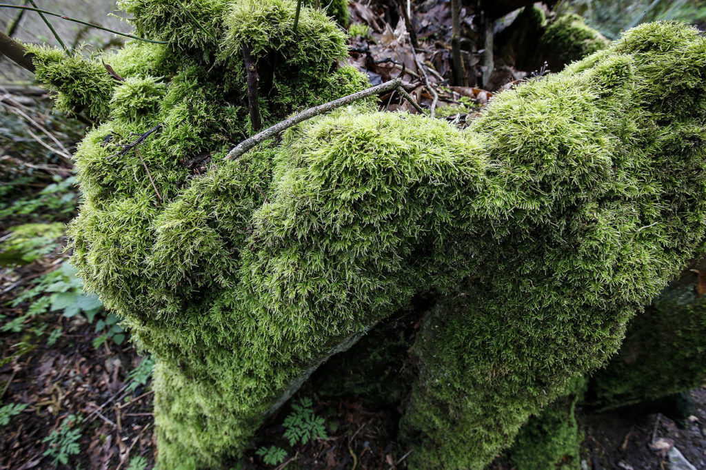
Hike through a deep ravine along a trail that follows a creek to a beach with views of Whidbey Is-land and the Olympic Mountains. The main trail through the 110-acre Meadowdale Beach Park drops 400 feet into the gulch. Among the mature forest, see gi-ant stumps of cedar and hemlock that were logged over a century ago. A staircase built into the hill-side helps with the descent into the gulch. At 1 mile, you’ll reach a fork in the trail. Turn left to continue on to the park ranger’s residence and a manicured lawn with a picnic shelter, volleyball net and picnic tables. Turn right to follow the creek to the Puget Sound. A railroad underpass leads to the beach. The trail is 2.5 miles roundtrip.
Big Gulch
4800 92nd St. SW, Mukilteo
The 180-acre Big Gulch Park in the center of Mukilteo has about 2.5 miles of trails. The trails are dotted with bridges and boardwalks as it follows a steam. One trail links 92nd Street Park to theMukilteo Library and Staybridge Suites. Another trail briefly follows the wastewater treatment pipeline and goes deep into the ravine. A steep stretch has steps up to or down from 92nd Street Park. The main trailhead and parking lot is at 92nd Street Park, which has restrooms, benches, picnic tables and playgrounds. The trails have a gain of 200 feet.
Jetty Island
10th Street and West Marine View Drive, Everett
Reach this beach hike via a 5-minute passenger ferry to the 2-mile-long man-made Jetty Island just off of Everett’s waterfront. While the island doesn’t have a loop trail, you can easily walk up to 5 miles roundtrip from end to end along the Possession Sound beach. Views include the Olympic Mountains, Whidbey Island, Camano Island, Hat Island and downtown Everett. The island also has a restroom, picnic tables and a small nature trail. There is no elevation gain. No dogs allowed. Ferry runs July 5 through Labor Day. Pick up free boarding passes at the ferry kiosk. Reservations are encouraged for busy days.
Scriber Lake
5322 198th St. SW, Lynnwood
Hidden in the center of Lynnwood’s shopping centers is Scriber Lake Park with wetlands, a forest and a creek. A trail loops around Scriber Lake, which features a floating boardwalk. Short nature trails with interpretive signs run throughout the 22-acre park. The hike is 1.2 miles roundtrip. There is no elevation gain. The park also has access to the 1.5-mile Scriber Creek Trail. That trail links Scriber Lake Park to Sprague’s Pond Mini Park, Scriber Creek Park and the Interurban Trail.
North Creek
1011 183rd St. SE, Mill Creek
The 85-acre North Creek Park features a network of floating boardwalk that snakes through an expansive wetland. Stop at interpretive signs and sit on benches along the way to get glimpses of wildlife living in the marsh. One trail spur leads to a peat bog and another spur to the main creek channel. The park has portable restrooms, shelters, picnic tables and a playground. The trails have a 20-foot gain. The trail, which begins and ends with a gravel trail, is 2 miles roundtrip.
Lord Hill
12921 150th St. SE, Snohomish
Located on a ridge above the Snohomish River, the 1,300-acre Lord Hill Regional Park has over 11 miles of hiking, biking and equestrian trails through a forest, wetlands and to a number of ponds. Print a trail map from snohomishcountywa.gov before you set out. This is another park with lots of trail legs and loops for a customizable hike. Try the Beaver Lake Loop for a 2.2-mile hike or the Temple Lake Loop for a 3.7-mile trip. Along the trails are views of the Cascade and Olympic mountains and the Snohomish River Valley. The park has picnic tables, a playground and river beach access. A portable restroom is in the parking lot. Some trails have a gain of up to 200 feet.
Portage Creek
5427 Cemetery Road, Arlington
The former peat and dairy farm near Smokey Point features a trail that follows a stream through 160 acres of wetlands and meadows. This trail also has interpretive signs and benches to help hikers look for wildlife hiding in the brush. The Portage Creek Wildlife Area is lined with alder, dogwood, cottonwood and other replanted native species. Along the way see views of the Cascade foothills. The trail is 1.2 miles roundtrip. There is no elevation gain. No dogs are allowed at this park.
Japanese Gulch
4407 76th St. SW, Mukilteo
The 140-acre Japanese Gulch Park along the Mukilteo-Everett border has about 7 miles of hiking and biking trails that follow the railroad tracks and a creek. The mature forest and wetlands are divided by Fifth Street into upper and lower ravines. The upper gulch has a 4-mile loop trail and the lower gulch has about a half-mile hike. Most trails in the gulch are unmarked. There are plans to add signs, picnic tables, restrooms and dirt jumps for mountain bicycles to the new Mukilteo park. The main trailhead and parking lot is next to a community garden. The trails have a gain of 175 feet.
Spencer Island
5033 Fourth St. SE, Everett
Cross a historic bridge to get to this marshy island in the Snohomish River Estuary with about 3 miles of trails. Snohomish County owns half and the Washington Department of Fish and Wildlife owns the other half. Turn right after you cross the Jackknife Bridge and follow a short trail to a boardwalk. Then find the island’s levee loop trail, which provides hikers with views of tidal wetlands, sloughs and mountains. Turn left after the bridge and hike an out-and-back trail. Dogs are allowed on the WDFW-owned portion of the park only. The 230-acre Spencer Island Regional Park has picnic tables and portable restrooms. There is no elevation gain.
Sara Bruestle: 425-339-3046; sbruestle@heraldnet.com. Twitter: @sarabruestle.
Talk to us
> Give us your news tips.
> Send us a letter to the editor.
> More Herald contact information.
Gallery